Surface Charts
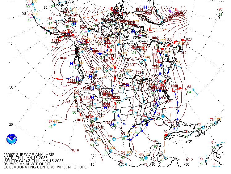
National SFC
Eastern SFC
Georgia Mesonet
Wx & Hazards Viewer
SPC Printable
Dacula Wx Page
Local Weather
National Forecast Chart
NWS Flowery Branch Fcst
Current Severe Weather
SPC Day 1
SPC Meso Analysis SE
NSSL MRMS Viewer
Regional NWS Offices
Birmingham Local Fcst
NWS Huntsville Local Fcst
NWS Jackson,MS Local Fcst
Storm Prediction Center
Day 1
Day 2
Day 3
Day 4-8
Watches
Meso Discussions
Meso Analysis
SPC Tools
Climate Prediction Center
MS TV
MS Scanner Freqs
1 Day Out / Day Of
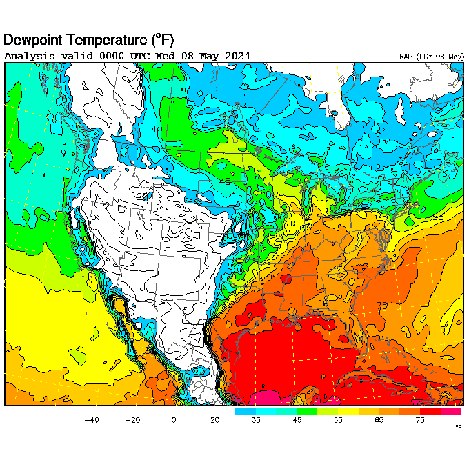
- Moisture / Instability – Surface Dewpoints > 55 F
COD HRRR Model (18 Hours Out/Updated Hourly) - Shear / Lift – 500mb Surface Winds > 30 kts (mid-level winds approx 5,000 ft high)
COD HRRR Model (18 Hours Out/Updated Hourly) - Day 1 SPC Convective Outlook
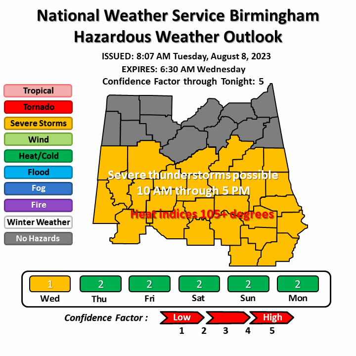
- Hazardous Weather Outlooks
Huntsville
Birmingham
Atlanta - 0-3KM CAPE > 100 J/kg for sfc based storms
- Lid Strength < 2 C for Significant tornado/ sfc based (discriminate between tornado / non-tornado areas)
2 Days Out
- Moisture / Instability – Surface Dewpoints > 55 F
COD NAM Model (Good 3.5 days out) - Shear / Lift – 500mb Surface Winds > 30 kts (mid-level winds approx 5,000 ft high)
COD NAM Model (Good 3.5 days out) - Day 2 SPC Convective Outlook
- Hazardous Weather Outlooks
Huntsville
Birmingham
Atlanta - 0-3KM CAPE > 100 J/kg for sfc based storms
- Lid Strength < 2 C for Significant tornado/ sfc based (discriminate between tornado / non-tornado areas)
3.5 Days Out
- Moisture / Instability – Surface Dewpoints > 55 FCOD GFS Model (Good for 3.5 – 5 days out)
COD NAM Model (Good 3.5 days out)
Do NAM and GFS match ? - Shear / Lift – 500mb Surface Winds > 30 kts (mid-level winds approx 5,000 ft high)COD GFS Model (Good for 3.5 – 5 days out)
COD NAM Model (Good 3.5 days out) - Day 3 SPC Convective Outlook
- Hazardous Weather Outlooks
Huntsville
Birmingham
Atlanta


